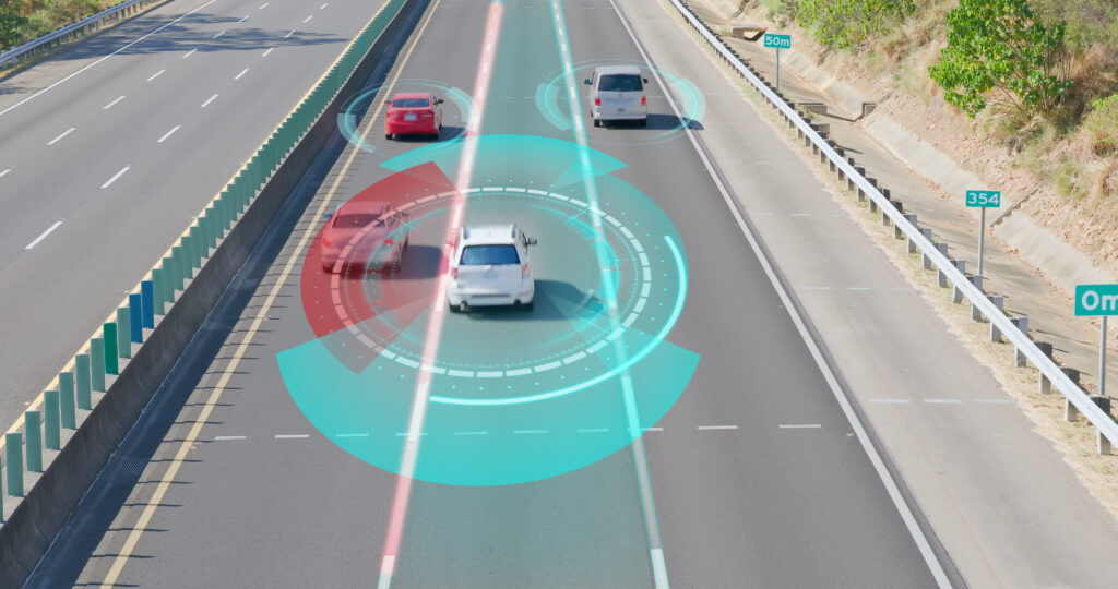
Autonomous Driving Integration
MAP IV provides comprehensive solutions to integrate autonomous driving technology into real-world driving environments.
We aim to ensure that operations are both safe and efficient.
Our services range from supporting the integration and operation of specific autonomous driving systems to applying autonomous driving technology in the real world.
Full Stack Solution With Autoware

Having broad experience deploying and supporting Proof-of-Concept integrations with major OEMs, we offer thorough and customized development services utilizing Autoware, the world’s first open-source autonomous driving software.
Our commitment to driving innovation in the industry is reflected in our premium membership in The Autoware Foundation; an international consortium focused on establishing industry standards for autonomous driving operating systems.
With our expertise in 3D mapping, self-localization, and perception, we are well-positioned to provide consultation support for the integration and operation of Autoware.
We take pride in our dedication to promoting this cutting-edge technology’s research, development, and practical deployment.
*’Autoware’ is an open-source autonomous vehicle framework based on the Robot Operating System (ROS). It includes all the functionalities required for autonomous driving, including vehicle localization, object detection, path planning and control. It was created to foster open innovation in autonomous driving technology, allowing more individuals and organizations to contribute.
* ‘Autoware’ is a registered trademark of The Autoware Foundation.
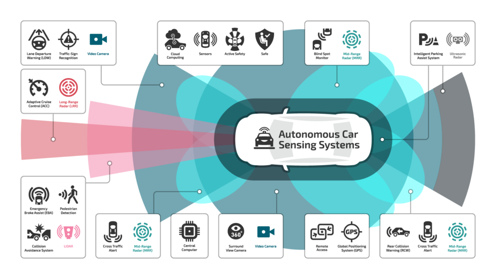
Components of an Autonomous Driving System
An autonomous driving system consists of the following components to ensure accurate and safe operation:

1. SENSING:
Uses sensors such as LiDAR, Radar, cameras and GNSS to collect information from the surroundings.
2. MAPPING:
Uses high-precision 3D map data to enable advanced capabilities in system recognition, decision-making, and operation.
3. LOCALIZATION:
Uses 3D maps, LiDAR and GNSS to accurately determine the vehicle’s position.
4. PERCEPTION:
Uses sensor data to detect surrounding objects, structures and situations, recognising the position of obstacles and the environment.
5. PLANNING:
Plans driving tasks and determines the vehicle’s next actions.
6. CONTROL:
Controls the vehicle and executes planned driving maneuvers.
Our Services
We provide support in various technical areas related to the integration of autonomous driving systems, tailored to the environment in which autonomous vehicles operate, including:
- ODD (Operational Design Domain) Design
- Performance Requirements Definition
- System Configuration Definition
- Sensor Configuration and Placement Design
- Autonomous Vehicle Integration
- Vehicle Adaptation
- Scenario Evaluation
- Autonomous Driving System Performance Assessment
- Field Operations
Why MAP IV?
- Comprehensive Technical Support
Our organization takes pride in its team of engineers with advanced proficiency in key technologies such as 3D mapping, positioning, and perception. We provide tailored consultation services to satisfy specific requirements and needs.
- Ongoing Operational Support Post-Integration
The successful integration of autonomous driving systems necessitates continuous operational support. This support extends to activities such as updating maps to reflect changes in road networks and adapting to software updates to enhance the system’s overall performance.
We have established a robust support system to ensure that the autonomous driving system operates safely and efficiently over extended periods. Our system is designed to provide the requisite support throughout its operational life, guaranteeing a consistent and reliable performance.
- Customization
Autonomous driving systems rely on multiple advanced technologies that require significant expertise and knowledge to apply to unique environmental conditions or customize the system.
Our team has extensive experience supporting these technologies’ implementation in various scenarios, including public roads, off-road scenarios, and challenging environments with limited functionality or poor satellite reception. With our expertise, we can help you navigate these complex technologies, optimize their performance, and ensure their seamless integration into your autonomous driving systems.
Support is also available for the following scenarios:

Open areas with no distinctive features, such as airports or farmland.
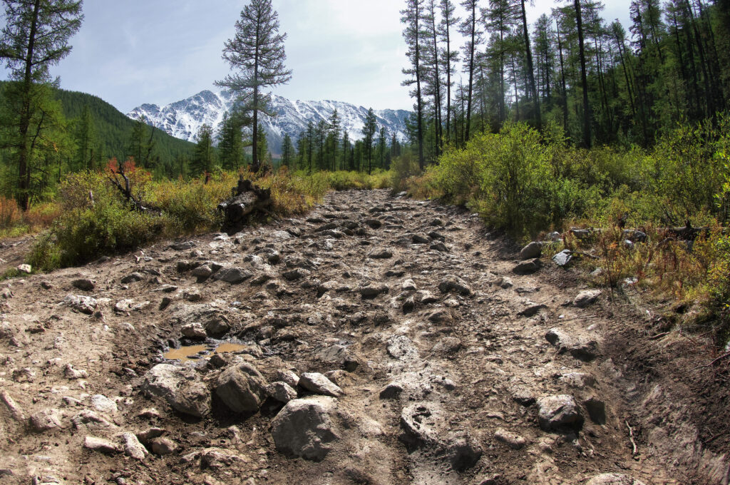
Locations where satellite reception is challenging, such as dense forests or indoor environments.

Urban areas with tall buildings that degrade GNSS accuracy due to multipath interference.
For inquiries, quotes, or other discussions, please contact us using our inquiry form.