MAP IV’s Dimensional Intelligence
MAP IV stands at the forefront of research, development, and societal implementation of advanced ‘Dimensional Intelligence’.
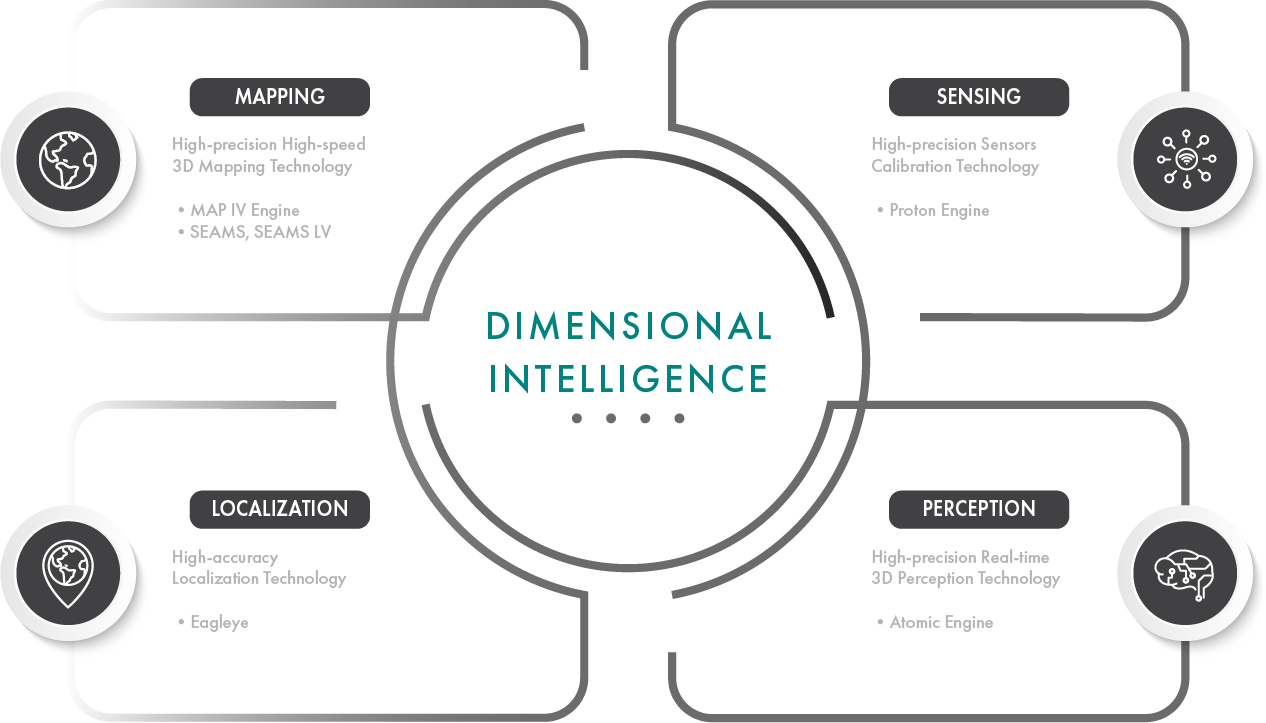
Dimensional Intelligence is a collective term for technologies that aims to precisely understand real-world 3D information,
encompassing the following four core technologies.
-
TECHNOLOGY 01SENSING & PERCEPTION
The technology of measuring real-world data using sensors is critical for realizing complex and advanced systems.
MAP IV uses a range of sensors, including 3D LiDAR, cameras, GNSS, IMU, Radar, and more, to acquire optimal data for object recognition, mapping, and localization.- Atomic Engine
- Proton Engine
- 3D LiDAR
READ MORE
-
TECHNOLOGY 02MAPPING & LOCALIZATION
The technology of utilizing sensors to generate real-world 3D map data is crucial for the development of autonomous driving systems and robotics.
LiDAR SLAM is the leading mapping technique among these technologies.- MAP IV Engine
- SEAMS
- Eagleye
- Data Production
READ MORE
-
TECHNOLOGY 03AUTONOMOUS DRIVING
INTEGRATIONMAP IV provides comprehensive solutions to integrate autonomous driving technology into real-world driving environments.
We aim to ensure that operations are both safe and efficient. Our services range from supporting the integration and operation of specific autonomous driving systems to applying autonomous driving technology in the real world.
The strength of MAP IV lies not only in the exceptional performance of its four core technologies, but also in the synergistic effects when these technologies are integrated.
For example, by applying Perception technology to 3D point clouds created using Mapping techniques, we can achieve advanced object recognition on the map.
As a result, tasks such as manual removal of unnecessary noise objects, detailed extraction of specific features and road markings, and automated cartography, which previously required human intervention, are streamlined for increased efficiency.
By combining multiple technologies, we can incorporate new survey data to expand and update map information smoothly.
Utilizing Localization technology to align with existing maps and then using Mapping technology for new areas ensures the addition of map data without discrepancies or errors.
Furthermore, Perception technology enables us to identify the precise details of the map’s temporal changes while extracting and updating the map differences.
MAP IV is committed to delivering innovative technological solutions by deepening expertise in each technical area and their integration.
“Dimensional intelligence” is poised to drive innovation in diverse fields such as autonomous driving, surveying, infrastructure maintenance, construction and XR.
We will continue to lead the transformation of society through these technological innovations.
