About Vector Map Generator
Our Vector Map Generator accelerates vector map creation by automatically detecting, classifying, and vectorizing objects from the 3D point cloud map and the camera data.
Vector maps compactly represent objects in the environment and contain rich semantic information, making them increasingly valuable in applications such as autonomous driving systems and simulators.
Vector map generation is a time-consuming process that involves manually identifying and labeling objects. With Vector Map Generator, these processes are automated and streamlined, enabling the rapid delivery of accurate and reliable vector map data.
Features
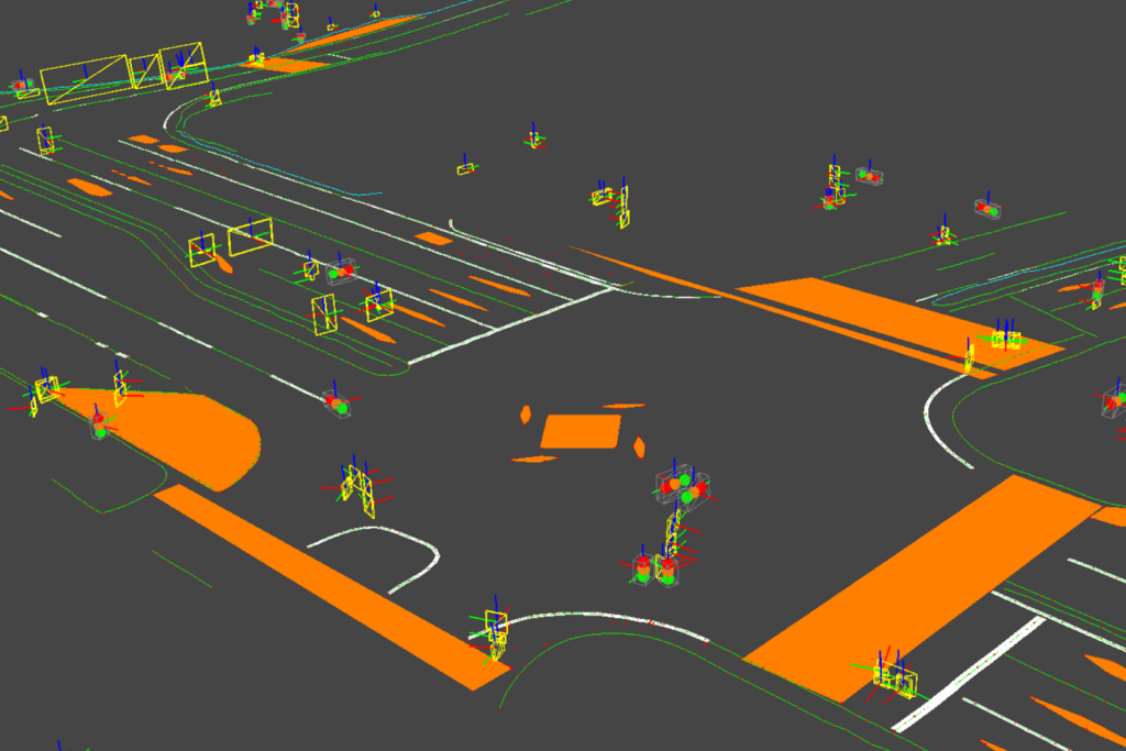
Vector Map Generator automatically detects the position and size of objects from data acquired by 3D LiDAR and cameras. It classifies them as traffic signs, traffic lights, and road markings. These data are then integrated and processed to output high-precision vector data.
1. Point Cloud Analysis
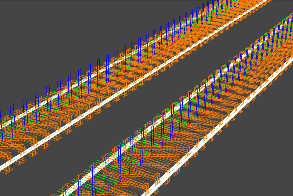
Automatically detects the position and size of objects from point cloud data acquired by sensors.

2. Image-Based Classification
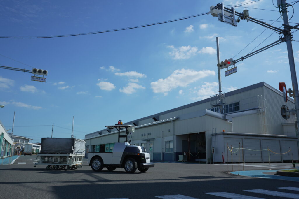
Uses camera images to classify the detected objects, such as traffic signs and traffic lights.

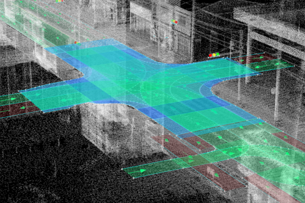
3. Data Fusion and Processing
Integrates point cloud data and image recognition results to generate high-precision, semantically labeled vector maps automatically.

Use Cases of Vector Maps
High-precision vector maps are increasingly being utilized across various industries, contributing to greater efficiency, automation, and accuracy in field operations.
Autonomous Driving & Mobility
Used for vehicle self-localization, path planning, and high-precision recognition of surrounding environments.
Infrastructure Inspection & Urban Development
Supports the maintenance of roads and signs, as well as situational analysis in urban planning.


Simulation & XR
Used in virtual environment reconstruction, driver training, and city planning simulations.

Public Safety & Disaster Prevention
Can be used to accurately and quickly convey an overview of accident scenes to third parties.
Examples of Automatically Detected and Classified Objects
- Lane markings, Stop lines, and Road surface markings
- Curbs, Guardrails, and Fences
- Pedestrian crossings
- Traffic signals
- Road signs